










Nantucket Low Hurricane: Understanding the Atlantic’s Most Powerful Storm Phenomenon
What Is a Nantucket Low Hurricane?
If you’ve ever wondered why New England gets hit so hard by storms that seem like they should have weakened by the time they travel this far north, the answer often comes down to something called a Nantucket Low. Named after the iconic Massachusetts island perched at the southern edge of New England, these intense low-pressure systems form when Atlantic hurricanes or tropical storms go through a dramatic transformation — shifting from warm tropical cyclones into what meteorologists call extratropical systems. And here’s the thing: that transformation doesn’t necessarily weaken them. In fact, it can spread their destructive power across a much wider area than the original hurricane ever covered.
Here’s what makes these storms so remarkable. When a tropical cyclone pushes northward along the Eastern Seaboard and starts bumping into the cooler waters and the powerful jet stream over the mid-Atlantic, something unexpected happens. Instead of just drawing on warm ocean surface temperatures the way a typical hurricane does, the storm starts pulling energy from the temperature clash between polar and tropical air masses. That dual energy source can cause the storm to reorganize entirely — expanding outward, maintaining its punch, and sometimes even intensifying as it moves away from the warm Gulf Stream water that got it started in the first place.
Among New England mariners, local meteorologists, and coastal residents, “Nantucket Low” is the shorthand for storms that stall near Nantucket Sound or barrel up from the south, wrapping enormous winds and storm surge around the region’s exposed coastlines. These systems can bring hurricane-force winds, severe coastal flooding, and towering waves to areas that aren’t even under official hurricane warnings — which is exactly what makes them so dangerous. People don’t always see them coming the way they would a traditional hurricane, and that’s reason enough to take them seriously.
The Meteorological Science Behind the Storm
To understand how a Nantucket Low works, you first need to understand a process called extratropical transition, or ET. As a hurricane drifts north out of the tropics, it runs into increasingly hostile conditions. Sea surface temperatures drop, the atmosphere’s structure shifts, and the storm starts to tilt and lose the compact, symmetric shape that defines a classic tropical cyclone. As all of this is happening, the storm runs headlong into frontal boundaries — those sharp dividing lines between warm tropical air and cold polar air that dominate weather patterns in the mid-latitudes.
That collision triggers what scientists call baroclinic intensification, which is essentially the storm tapping into a brand-new energy source. All that potential energy stored in the contrast between warm and cold air masses gets converted into powerful winds and spiraling precipitation. At the same time, the storm grows. A typical Atlantic hurricane might span 200 to 300 miles across, but an extratropical system near Nantucket can spread damaging winds over an area two to three times that size, affecting communities from the Mid-Atlantic coast all the way up to Maritime Canada.
Upper-level atmospheric dynamics add another layer of complexity. A strong dip in the jet stream can act almost like a vacuum, dragging the remnant tropical system northward while simultaneously cranking up its intensity. The timing of that upper-level trough lining up with the low-level storm remnant is a delicate, somewhat chaotic process — and even modern computer models struggle to nail it more than two or three days out. That forecasting uncertainty is a big part of why Nantucket Low events still manage to catch coastal communities off guard, even with all the satellite technology and weather modeling tools we have today.

Historical Examples of Devastating Nantucket Low Events
History has a way of putting the danger of these storms in very stark terms. The Great New England Hurricane of 1938 — better known as the Long Island Express — is probably the most notorious example of what a rapidly transitioning tropical system can do to the northeastern coast. It moved at the almost unbelievable forward speed of nearly 70 miles per hour, giving residents virtually no time to evacuate before it slammed ashore with a 14-to-17-foot storm surge. Entire beach communities were wiped out. Thousands of trees toppled. Somewhere between 600 and 800 people died across Long Island, Connecticut, Rhode Island, and Massachusetts.
More recently, Hurricane Bob in 1991 put Nantucket and the surrounding islands squarely in the crosshairs. Making landfall near Westerly, Rhode Island, Bob drove winds exceeding 100 miles per hour across Nantucket, caused widespread structural and tree damage throughout the island, and left the local economy struggling for years. When you consider the island’s low elevation, its exposure to both Nantucket Sound and the open Atlantic, and the narrow straits separating it from the mainland, it’s easy to see why it’s so vulnerable to the kind of elevated storm surge these systems produce.
And then there’s Hurricane Sandy in 2012. Sandy wasn’t a textbook Nantucket Low in the traditional geographic sense, but it gave the modern world a vivid, unforgettable demonstration of what extratropical transition can do to an already powerful storm. When Sandy merged with a continental cold front and made its bizarre left turn into New Jersey, it became a hybrid superstorm with a wind field so enormous it affected weather from the Great Lakes to North Carolina’s Outer Banks. More than 200 people died across the Caribbean and the United States, roughly 65 billion dollars in damage was tallied, and emergency managers and scientists fundamentally changed how they think about post-tropical cyclone threats in the Northeast.
Other storms have also shaped the regional understanding of what Nantucket Lows can do:
- The Portland Gale of 1898, which sank the steamer SS Portland with over 190 passengers and crew off Cape Cod — still one of the worst maritime disasters in New England’s history.
- Hurricane Carol in 1954, which struck southern New England with almost no warning, causing devastating flooding across Connecticut and Rhode Island and killing 65 people.
- The Perfect Storm of 1991, formally called the Halloween Nor’easter, which formed when a dying cold front absorbed energy from Hurricane Grace and sent 30-foot waves crashing into the New England coast.
- Hurricane Irene in 2011, which dragged storm surge and inland flooding from the Carolinas all the way through Vermont, offering yet another reminder of how far the reach of these transitioning systems can extend.
Coastal Impacts and Infrastructure Vulnerability
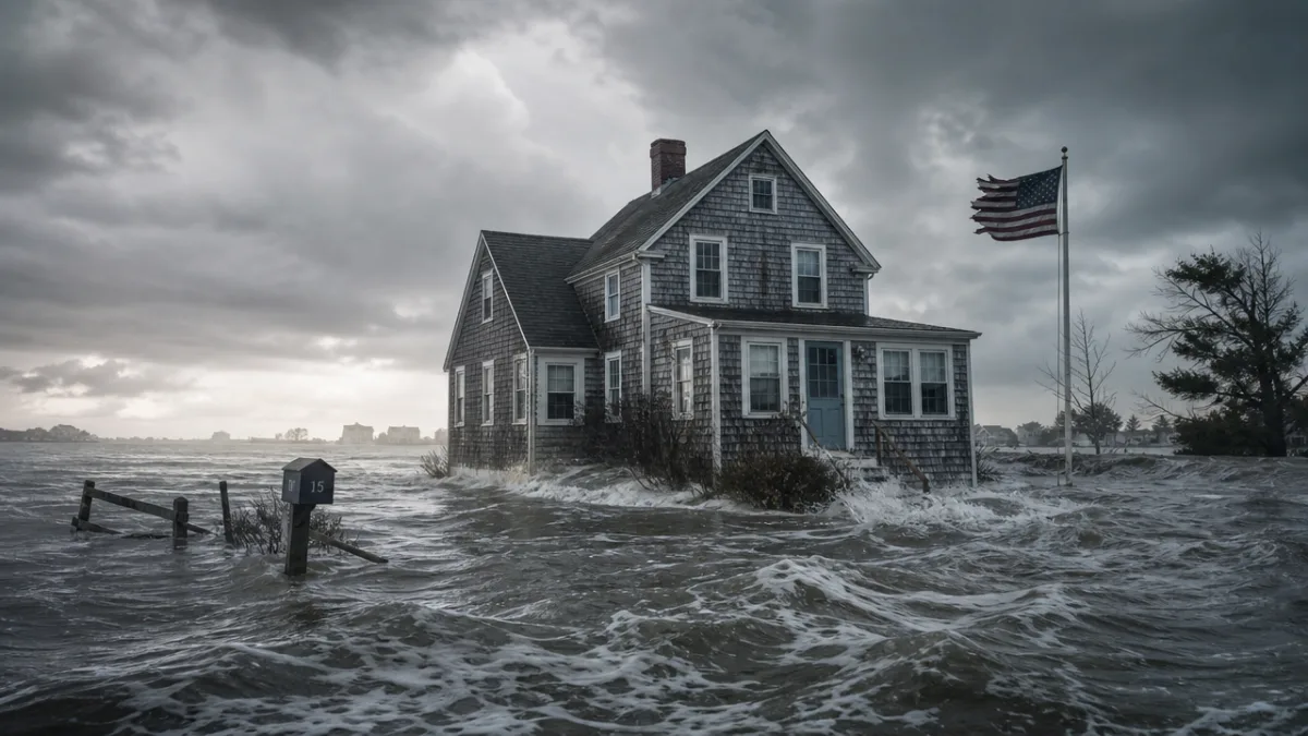
The damage a Nantucket Low inflicts doesn’t stop at the water’s edge. These storms reach into river valleys, overwhelm transportation networks, and knock out critical infrastructure far from the shoreline. Storm surge is almost always the deadliest piece of any major coastal storm, and Nantucket Lows are especially good at producing catastrophic surge because their expanded wind fields push enormous volumes of water against the curved coastline of southern New England. The funnel-shaped geometry of Narragansett Bay, Cape Cod Bay, and Long Island Sound makes things even worse — water piles into those semi-enclosed bodies with nowhere to go, amplifying surge heights well beyond what open-coast models might suggest.
The region’s aging infrastructure makes all of this harder to manage. A lot of the seawalls, bulkheads, and coastal protection structures in southern New England were built in the early-to-mid twentieth century, engineered to handle storm conditions that scientists now recognize were typical of a different ocean and a lower sea level. As sea levels along the northeastern United States continue rising — at rates that are among the fastest anywhere on Earth, driven by a combination of warming oceans and gradual land subsidence — the protection those old structures offer keeps shrinking. A surge that barely crested a seawall in 1960 can now flood the same community at a lower storm intensity, simply because the baseline water level has crept up.
Transportation gets hammered too. Nantucket and Martha’s Vineyard depend entirely on ferry and air service to stay connected to the mainland, and both shut down the moment Nantucket Low conditions arrive. Coastal roads and bridges can be buried under sand and debris within hours of a storm passing through. Underground utility systems — electrical conduits, communication cables — get hit by saltwater inundation over and over again, leading to outages that stretch for weeks. Emergency managers across the region have poured more resources into pre-storm preparation because of exactly this pattern: voluntary evacuation programs for barrier island residents, flood insurance outreach, community drills. The storms keep coming, and the investment in readiness has to keep pace.
Climate Change and the Future of Nantucket Low Events
Scientists are actively working to understand how a warming climate will change the behavior of transitioning tropical cyclones near Nantucket, and the picture that’s emerging is concerning. The current weight of evidence suggests that while the total number of Atlantic hurricanes probably won’t increase dramatically as global temperatures rise, the share of those storms reaching Category 4 or Category 5 intensity is likely to grow. That shift toward fewer but stronger hurricanes matters directly for the Nantucket Low phenomenon — because a more powerful parent hurricane carries more momentum, more latent heat energy, and more storm surge potential into the extratropical transition process.
Warming sea surface temperatures are also pushing the boundaries of where tropical cyclones can stay strong. Historically, the rapid cooldown of ocean waters north of Cape Hatteras acted as a natural brake on hurricanes tracking up the coast, starving them of the warm water they needed to sustain tropical-force winds. As those northern waters warm, that brake weakens. Computer modeling studies from the past decade suggest that by the end of the twenty-first century, Atlantic hurricanes could maintain tropical intensity much farther north than they do today — potentially arriving at Nantucket Sound with significantly more force before ever beginning their extratropical transition.
Sea level rise compounds every other risk factor in the equation. Boston, Providence, and New York are all recording sea level increases that outpace the global average, driven partly by actual ocean rise from thermal expansion and ice melt, and partly by the land itself slowly sinking — a geological hangover from the retreat of ice sheets after the last glacial maximum. Even one extra foot of baseline sea level means that a Nantucket Low generating a 12-foot storm surge effectively delivers the flooding impact of a 13-foot surge under pre-industrial conditions, pushing devastation deep into neighborhoods that once sat comfortably above the flood line.
Preparedness, Forecasting, and Community Resilience
Getting ready for Nantucket Low hurricanes isn’t something any single agency or level of government can handle alone. It takes a layered effort running from individual households all the way up to federal agencies, all working in coordination. The National Hurricane Center and the Weather Prediction Center have made real strides in recent years on exactly this problem, recognizing that handing off a transitioning tropical system from tropical to extratropical forecasting protocols requires seamless communication — and that gaps in that handoff can cost lives. New forecast products, including improved storm surge inundation maps and rainfall forecasting tools, now give emergency managers far more actionable information than they had even ten years ago.
At the local level, coastal towns across Cape Cod, the Islands, and the Rhode Island and Connecticut shorelines have built out and refined emergency response plans that account specifically for how quickly and broadly Nantucket Low events can escalate. Some of the most effective community-level strategies include:
- Keeping evacuation routes and shelter locations current, factoring in today’s traffic volumes and the steady growth of coastal populations.
- Setting up pre-storm mutual aid agreements between neighboring towns so heavy equipment, generators, and emergency personnel can move across municipal lines without bureaucratic delays.
- Investing in real-time coastal monitoring — tide gauges, wave buoys, automated weather stations — to provide ground-truth data for forecast models when storms are rapidly evolving.
- Running regular public education campaigns that reach both year-round residents and the large seasonal tourist population, making sure people know the specific risks for their location and what they’re supposed to do about them.
- Developing targeted outreach for vulnerable populations, including elderly residents, people with disabilities, and non-English-speaking communities, who often face particular barriers when trying to receive and act on emergency warnings.
At the end of the day, individual and household preparedness is the foundation everything else rests on. No government agency, no matter how well-funded or well-organized, can substitute for a family that has put together an emergency kit, knows its evacuation zone, has made a plan for pets, and has actually talked through what everyone is going to do if a storm hits. For Nantucket Low events specifically, that means understanding that warnings may come with less lead time than a classic slow-moving hurricane — and that conditions can go from manageable to dangerous very fast once a transitioning cyclone starts interacting with mid-latitude weather systems.
The longer-term question is harder. Some barrier beaches and low-lying coastal neighborhoods are becoming genuinely difficult to protect as storms intensify and seas rise. Communities across southeastern Massachusetts are already wrestling with the economics and ethics of managed retreat — the planned, voluntary relocation of homes and infrastructure away from places that can no longer be defended at a reasonable cost. These aren’t easy conversations. But they’re necessary ones if coastal New England is going to stay livable in the face of a threat that has shaped its past and will keep shaping its future.









What do you think?
It is nice to know your opinion. Leave a comment.