










Arizona: Where Desert Beauty Blooms in Every Season
Arizona is one of those rare places on earth that defies every expectation you bring to it. Most people arrive imagining a flat, monotonous stretch of sand and cacti baking under a relentless sun, only to find themselves standing slack-jawed before towering red rock formations, pine-covered mountain ranges, and wildflower meadows that seem almost impossible in the high desert. This is a state of profound contrasts, where elevations swing from below sea level in the lowlands to above 12,000 feet in the White Mountains, and where the landscape transforms so dramatically that a two-hour drive can feel like traveling between entirely different worlds.
The name Arizona itself carries a kind of poetry, believed by many historians to derive from the O’odham words meaning “small spring” or “place of the small spring,” a fitting origin story for a land where water has always been the organizing principle of life. Indigenous peoples understood this intimately, building their civilizations around rivers, springs, and the careful management of rainfall. The Hohokam constructed one of the most sophisticated canal systems in the ancient world right where Phoenix now stands, a testament to human ingenuity flourishing in an environment most outsiders would consider inhospitable.
What draws millions of visitors and transplants every year is harder to quantify than geography or history. There is something in the quality of the light here, the way the sun moves differently across the sky, the way shadows pool in the folds of canyon walls at dusk, the way a spring morning in the desert smells of rain and creosote and something ancient and clean. Arizona gets under your skin in ways that are difficult to articulate and nearly impossible to forget, whether you spend a weekend or a lifetime within its borders.
The Desert in Bloom: Arizona’s Spectacular Spring Wildflowers
Few natural spectacles in North America rival the Arizona desert in full bloom. Each year, typically between February and April depending on winter rainfall patterns, the Sonoran Desert transforms into a canvas of extraordinary color. Poppies unfurl in electric shades of orange that seem almost neon against the pale earth. Lupine spreads in pools of violet and blue along roadsides and hillsides. Desert marigold and brittlebush contribute waves of yellow that catch the morning light and seem to glow from within. The timing and intensity of these blooms varies year to year, driven by the amount and timing of winter precipitation, but when conditions align, the result is breathtaking on a scale that photographs cannot adequately capture.
The star of any Arizona spring bloom is undoubtedly the saguaro cactus, the towering sentinel of the Sonoran Desert that has become the state’s most iconic symbol. Saguaros bloom in May and June, producing large white flowers at the tips of their arms and crowns that open at night and remain accessible through the following day. These flowers are critically important to the desert ecosystem, providing nectar and pollen to a range of pollinators including bats, white-winged doves, bees, and numerous insects. The fruit that follows, a brilliant red pod that splits open to reveal deep crimson flesh, has been harvested by the Tohono O’odham people for centuries as part of their annual ceremonial cycle welcoming the new year.
Beyond the saguaro, the diversity of blooming plants in Arizona’s various desert zones is staggering. The Chihuahuan Desert in the southeastern corner of the state produces its own distinct array of blooms, including the spectacular century plant, which spends decades storing energy before sending up a towering flower spike that can reach thirty feet in height. Higher elevation desert grasslands offer still more variety, with wildflowers like Indian paintbrush, globe mallow, and sacred datura appearing in meadows and along washes. Arizona’s reputation as a destination for wildflower enthusiasts has grown substantially in recent years, with dedicated bloom-chasers traveling from across the country to witness these fleeting displays of desert vitality.
- Poppies typically peak in the lower desert elevations from mid-February through March, with Antelope Valley and the Wickenburg area offering some of the most reliable displays.
- Brittlebush and desert marigold bloom slightly later and at higher elevations, making April a productive month for exploring areas around Tucson and the Santa Catalina foothills.
- The monsoon season triggers a second, often overlooked bloom cycle in late summer, when the desert responds to sudden summer rains with an eruption of pink, white, and yellow flowers across the landscape.
Red Rock Country: The Geological Wonder of Sedona and Beyond
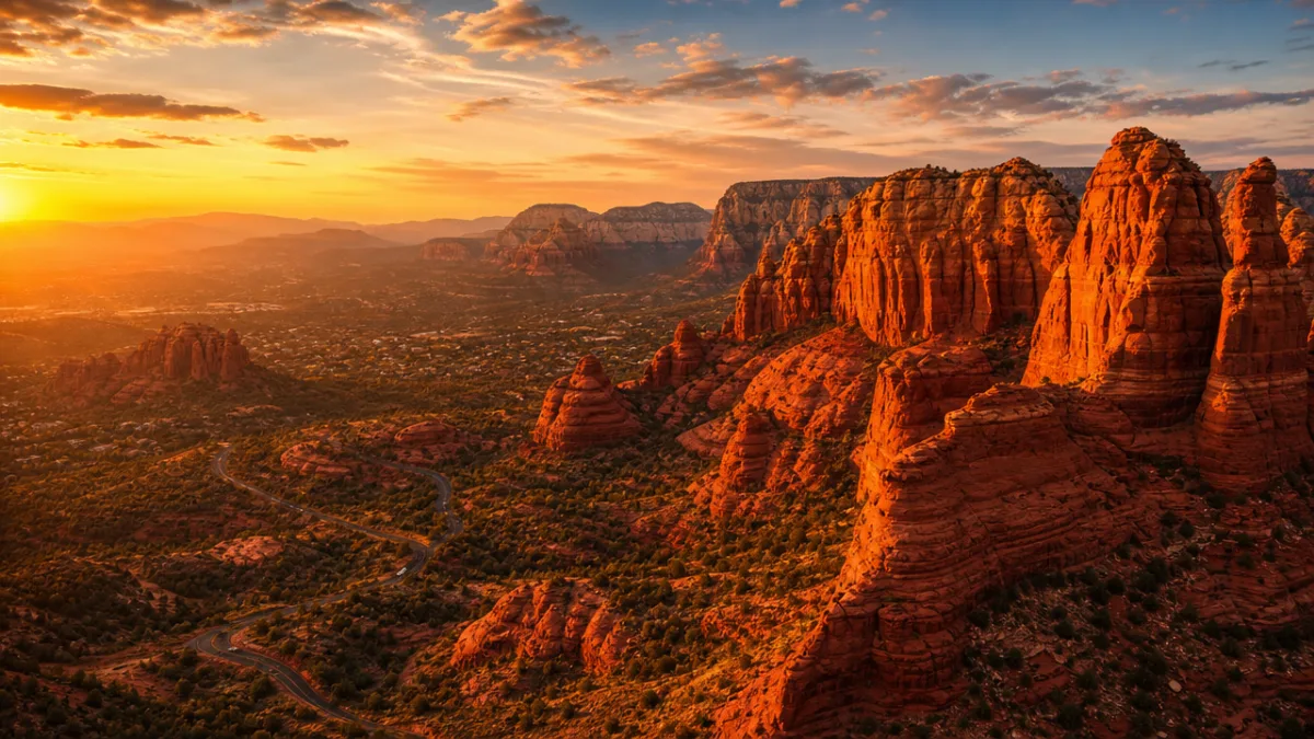
There is no landscape in the American Southwest quite like the red rock country surrounding Sedona, a small city nestled in a valley carved by Oak Creek in north-central Arizona. The formations here — Cathedral Rock, Bell Rock, Courthouse Butte, the Coffee Pot — rise from the earth in shapes so dramatic and so precisely beautiful that they seem intentionally designed rather than the product of millions of years of erosion acting on layers of sandstone and limestone. The color of these rocks changes throughout the day in ways that reward slow attention: pale pink in the earliest light of dawn, deepening to russet and crimson by midmorning, burning almost red-orange by afternoon, and settling into deep purple shadow as the sun descends toward the horizon.
Geologists explain Sedona’s distinctive landscape as the result of differential erosion acting on the Schnebly Hill Formation, a sequence of sedimentary rock layers deposited roughly 330 million years ago when a shallow sea covered much of what is now Arizona. The iron oxide in these sandstone layers gives them their characteristic red and orange coloration, while harder cap rocks of limestone have protected certain formations from erosion, leaving them standing as monuments above the surrounding terrain. The Verde Valley in which Sedona sits was carved by the same forces that eventually created the Grand Canyon to the north, making the entire region a kind of living geological textbook spread across a stunning natural landscape.
Sedona has also become famous in recent decades for a more esoteric form of attraction: its so-called energy vortexes, sites where believers say the earth’s energy fields create a palpable sense of heightened awareness, emotional clarity, and spiritual connection. Whether or not one subscribes to this framework, there is no denying that Sedona’s landscape produces a strong effect on visitors. People regularly report feeling moved, calmed, or inspired in ways that are difficult to explain rationally. The combination of extraordinary natural beauty, the quality of the silence in certain canyons and on certain hilltops, and the overwhelming sense of geological time at work creates an atmosphere that is genuinely unlike anywhere else on the planet.
The Grand Canyon: Confronting the Immensity of Deep Time
No article about Arizona can bypass the Grand Canyon, though no amount of writing can adequately prepare a first-time visitor for the actual experience of standing at the rim and looking out over one of the earth’s most profound geological features. The canyon is 277 river miles long, up to 18 miles wide, and more than a mile deep in its deepest sections. These are statistics that the human brain processes as data without truly comprehending, until the moment you walk up to the rim and the full scale of it opens before you, and something shifts in your understanding of both the earth and your own smallness within it. Many visitors report standing in silence for long minutes, unable to speak, simply absorbing the visual information in front of them.
The canyon’s walls reveal 1.8 billion years of earth’s geological history in visible cross-section, with distinct bands of rock representing vastly different eras and environments. The oldest rocks at the bottom of the canyon were formed before complex life existed on earth, while the rim is composed of limestone laid down by ancient seas roughly 270 million years ago. The Colorado River, which carved the canyon over the past five to six million years as the Colorado Plateau gradually uplifted, still runs along the bottom, a narrow ribbon of green-brown water visible from many rim viewpoints as a reminder that this landscape is still actively being shaped. The process of erosion that created the canyon continues every day, invisibly but relentlessly.
Visiting the Grand Canyon responsibly requires planning and respect for both the environment and the physical realities of the terrain. The South Rim, which is accessible year-round and receives the majority of the park’s approximately six million annual visitors, offers a range of perspectives from developed viewpoints along the rim trail. But the canyon’s true character reveals itself to those willing to descend into it, where temperatures, ecosystems, and the psychological experience of the landscape change dramatically with every thousand feet of elevation lost. The inner canyon is a desert within a desert, brutally hot in summer and starkly beautiful in all seasons, demanding adequate preparation but offering rewards commensurate with the effort required to reach them.
- The South Rim is open year-round and is the most accessible entry point, with shuttle services connecting major viewpoints and trailheads during peak season.
- The North Rim, higher in elevation and significantly less visited, is open from mid-May through mid-November and offers a quieter, more intimate experience of the canyon’s northern perspectives.
- Phantom Ranch, the only lodging below the rim, requires reservations made months or even years in advance and can be reached by mule or on foot via the Bright Angel or North Kaibab trails.
Indigenous Heritage: The Deep Human History of the Arizona Landscape
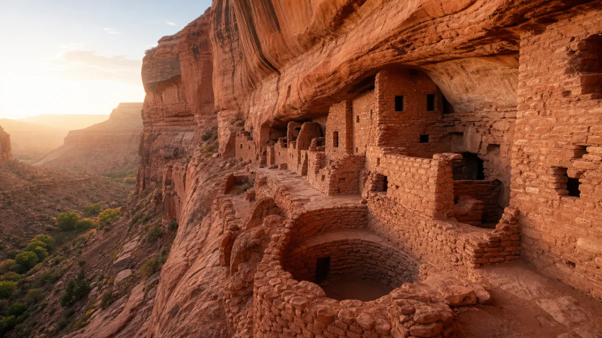
Arizona has been home to human communities for at least 13,000 years, and the evidence of these long habitations is woven into the landscape in ways that reward curious and respectful attention. The ancient Puebloan peoples left behind extraordinary cliff dwellings at Montezuma Castle, Tuzigoot, and Canyon de Chelly, built into and against cliff faces with a precision and elegance that continues to astonish modern visitors. At Canyon de Chelly in northeastern Arizona, still home to Navajo families who farm its canyon floor, you can see petroglyphs and pictographs dating back thousands of years alongside ruins of cliff dwellings constructed by people who occupied this land centuries before European contact. The canyon is one of the most continuously inhabited places in North America, its human story stretching in an unbroken thread from ancient times to the present day.
The Navajo Nation, which occupies a vast territory spanning northeastern Arizona, southeastern Utah, and northwestern New Mexico, is the largest Native American reservation in the United States by both land area and population. Visiting the Navajo Nation, including the iconic Monument Valley with its towering sandstone buttes, is an experience that carries specific responsibilities. Many areas require Navajo guides, and certain sites are restricted out of respect for their cultural and spiritual significance. Engaging with Navajo-owned tourism operations, staying in tribally owned accommodations, and purchasing art and crafts directly from Navajo artists are meaningful ways to ensure that visitor dollars contribute directly to the communities whose land and culture you are experiencing.
The Tohono O’odham Nation in southern Arizona maintains a living relationship with the Sonoran Desert that spans thousands of years, and their traditional ecological knowledge of desert plants, animals, water management, and seasonal cycles represents an irreplaceable body of wisdom about sustainable life in an arid environment. The annual saguaro fruit harvest, conducted each June, is not merely a cultural practice but an act of ecological participation in the desert food web and a ceremony that marks the O’odham new year. Efforts by tribal members, universities, and conservation organizations to document and preserve this knowledge represent some of the most important cultural preservation work happening anywhere in the American Southwest today.
Arizona’s Surprising Diversity: Mountains, Forests, and Sky Islands
The common perception of Arizona as purely a desert state does a profound disservice to the actual ecological diversity contained within its borders. The state encompasses seven of the world’s recognized biomes, from the Chihuahuan and Sonoran deserts at its lower elevations to boreal forest and alpine tundra at the summits of its highest mountains. This vertical diversity is concentrated most dramatically in the Sky Islands, a series of isolated mountain ranges rising from the desert floor of southeastern Arizona like botanical and biological arks, each harboring its own distinct community of plants and animals shaped by millennia of relative isolation from other mountain habitats.
The Madrean Archipelago, as these Sky Island ranges are collectively known, is recognized internationally as one of the world’s most significant biodiversity hotspots. The Chiricahua Mountains, the Santa Ritas, the Huachucas, and the Pinaleños each support communities of species found nowhere else, including numerous endemic plants and invertebrates, as well as serving as critical habitat for species that range across the U.S.-Mexico border. The borderlands region is one of the most important wildlife corridors in North America, supporting populations of coatimundi, javelina, and ocelot, as well as occasional jaguars that cross from their strongholds in the Sierra Madre of Mexico into the remote canyons of the Arizona highlands.
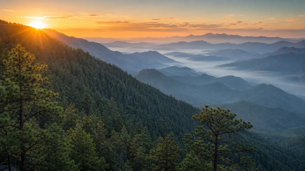
Northern Arizona surprises visitors with landscapes that bear no resemblance to the desert postcard version of the state. Flagstaff, situated on the Colorado Plateau at an elevation of nearly 7,000 feet, is surrounded by the largest contiguous ponderosa pine forest in the world. The San Francisco Peaks north of the city include Humphreys Peak, Arizona’s highest point at 12,633 feet, where a short hiking season reveals alpine wildflower meadows and sweeping views across the plateau to the distant rim of the Grand Canyon. Flagstaff receives an average of 100 inches of snow annually, supporting a ski resort that operates each winter and offering a completely different experience of Arizona than the one most visitors expect when they arrive in the state.
- Ramsey Canyon in the Huachuca Mountains is considered one of the premier birdwatching destinations in North America, hosting more than fourteen species of hummingbird and drawing dedicated birders from around the world each summer.
- The White Mountains in eastern Arizona offer some of the state’s best trout fishing, hiking, and mountain biking, with a network of streams and lakes that support robust populations of native Apache trout, a species found nowhere else on earth.
- Oak Creek Canyon south of Flagstaff is a dramatic red rock gorge carved by the same creek that flows through Sedona, offering swimming holes, hiking trails, and campgrounds amid scenery of exceptional beauty throughout the warmer months of the year.
Planning Your Arizona Journey: Seasons, Logistics, and Lasting Impressions
Understanding Arizona’s climate is essential to planning a visit that matches your interests and physical comfort. The low desert regions, including Phoenix, Scottsdale, and Tucson, are best visited from October through April, when daytime temperatures are comfortable and the landscape is at its most welcoming. Summer in the low desert is genuinely extreme, with daytime temperatures regularly exceeding 110 degrees Fahrenheit and nighttime lows that offer little relief. The monsoon season, which runs roughly from mid-June through September, brings dramatic afternoon thunderstorms to much of the state, transforming the desert with sudden greenery and filling dry washes with dangerous flash floods that can appear with little warning miles from the actual rainfall.
The higher elevation areas of the state, including Flagstaff, Sedona, the Grand Canyon’s South Rim, and the Sky Islands of the southeast, are viable destinations in summer when the low desert is at its most inhospitable. Summer temperatures in Flagstaff rarely exceed 85 degrees, and the monsoon season brings afternoon thunderstorms that clear the air and fill the forests with a heady, resinous scent. The Grand Canyon’s inner canyon, however, becomes genuinely dangerous in summer, with temperatures at the canyon bottom regularly exceeding 110 degrees and an annual toll of heat-related injuries and deaths among hikers who underestimate the severity of the environment and the physical demands of ascending steep trails in extreme heat.
Arizona rewards slow travel more than almost any destination in the American West. The temptation, particularly for visitors with limited time, is to compile a checklist of famous sites and race between them, never fully absorbing any single experience. But the state’s greatest gifts are not primarily the famous viewpoints or the iconic landmarks, as magnificent as those are. They are the quieter moments: the dawn light arriving on canyon walls before other visitors have reached the viewpoint, the silence of a desert wash where a Harris’s hawk circles overhead, the smell of rain approaching across a valley of mesquite and sage, the conversation with a Navajo guide who shares his knowledge of his family’s land with an openness and generosity that changes how you understand the relationship between people and place. These are the impressions that stay with you long after you have returned home, calling you back to Arizona in dreams and in the particular quality of certain slants of late afternoon light.








What do you think?
It is nice to know your opinion. Leave a comment.